The Far East areas of Gippsland in Victoria offers many options for exploring (preferably with a 4WD or perhaps a AWD SUV) remote coastal beaches and remote alpine cool and warm temperate rainforests.
You should expect that in most of these areas there will be NO mobile phone coverage and hence no internet, so you need to plan for this in advance – ensure you have road maps (if hiking, then appropriate topographic maps), advance downloading of Google maps (and other phone maps) for offline use, and if you are hiking then you should take a pre-registered radio beacon EPIRB (and ensure you have updated your account with your trip details and car registration).
In addition, once you leave the main towns or Orbost, Nowa Nowa, Buchan and Cann River, you should expect to find NO food shops or petrol stations, so you need to ensure you have a full tank, plenty of water and some food.
Finally, before you go, check the Vic Emergency app to check for bushfires and road closures which may impact your trip and check the weather forecast – storms or wet weather are likely to create dangerous conditions or at the very least make some of the roads far more difficult to negotiate with slippery roads, potential trees blown across them and possible fires due to lightning strikes.
The McKillops Bridge circuit
This is full day trip is possible perhaps even with a 2WD (in dry conditions with care and skipping the Balley Hooley camp ground segment) and starts from Orbost and can return back to Orbost (or various other return routes can be taken).
The 1st segment from Orbost to Balley Hooley camp ground
There are two main alternate routes via Buchan where you have the option of visiting the Buchan limestone caves:
“Scenic route” via the Snowy River valley on the Orbost-Buchan Rd:
- an option is to take a side route to Stringers Knob Historic Fire Tower by turning left at Monument Track and further on to Mottle Range Flora Reserve (the only known naturally occurring stand of E.maculata – spotted gum in Victoria)
- from there head to Buchan on the Mottle Range Rd (84min, 63km to the Basin Rd intersection)
The “Google route” via the main highways:
- take the Princes Hway to Nowa Nowa then up to Buchan
- take the Buchan-Orbost Rd and turn left onto Basin Rd (55min, 76km to this intersection)
Balley Hooley camp ground
This is a nice, small free camp ground where the Buchan River joins a bend of the Snowy River which makes it a nice spot for canoes and kayaks and perhaps a swim but the shores are rocky without sandy beaches and the water can be muddy. You will need a AWD or 4WD for the somewhat steep segment of gravel road down to the camp ground with some ground clearance required.

Tulloch Ard forest drive
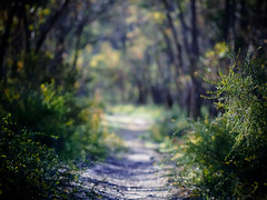
This is a nice drive through various types of forests northwards until you reach some lovely alpine vistas and head back to bitumen at Butcher’s Ridge.
This section offers a few side routes including:
- Basin Creek Falls – apparently great views and walk to falls
- Ash Saddle – walking track and picnic area (750m walk)
- Tulloch Ard Lookout walk – 3.2km return 1.5hrs, mostly easy with some steep sections and rough surfaces and steps
Once back on the bitumen, head north through Gelantipy (no shops or fuel) to the McKillops Rd junction and take this road north-west, through some very nice forests to Little River Falls.
Little River Falls to McKillops Bridge
This 16.5km segment of road is NOT recommended for vans as it is one of Victoria’s most precarious roads – a winding, downhill narrow gravel road with many blind corners and very few options for room for another passing car with a steep cliff on one side – take it slowly and with care as it is not a one way road!
Little River Falls picnic ground is on the side of this road at the start, although unless there have been rains the river is likely to be dry, but it is a nice spot for a bite to eat.
There is a side option to drive to the Little River Gorge Lookout which overlooks Victoria’s steepest gorge, although you can still see some of this further down the McKillops Road as shown here in this panoramic stitch I took:

As you are now heading down the north slopes of the Great Dividing Range, it becomes noticeably hotter and drier with more stunted mallee-like forests around the bridge area with temperatures some 5degC warmer
There is a Little River camp ground on the way down, and you can also camp on the north-east side of McKillops Bridge – both are free camp grounds.


Deddick valley drive
From McKillops Bridge you drive along the cliff face overlooking the Deddick River on a winding gravel road which from my view, lacks photographic appeal and has no options for camping until you reach Ambyne where there is a suspension bridge and the start of a section with some free camp sites.
The road turns to a general south-easterly direction through to Tubbut and on to Bonang – neither have shops or fuel.
Not far from Bonang is The Scenic Gap Reserve and a 3hr steep walk down to the Errinundra Old Growth Forest walk – although you will need hiking poles and be prepared for snakebites as this is not only remote without phone reception but parts of the path are overgrown making it impossible to see a resting snake.
From Bonang, you have a range of return options.
- bitumen highway to Bombala then to Cann River
- this is probably your best option if you either need food or fuel, or you are running out of daylight or a storm is coming or been
- Bombala is a good size rural town with a platypus centre and some interesting buildings
- before getting to Bombala, the smaller town of Delegate has some interesting buildings and nice rural rolling hill views
- the highway back to Cann River takes you past Coopracambra NP and there is a short side route to Beehive Falls
- mainly mountain bitumen to Goongerah and then Orbost
- Although this part seems popular with motorcyclists, I found this quite a boring winding mountain drive with the added issue of logging trucks, but the Goongerah camp ground is a lovely little free camp site alongside a clear stream which is well worth considering for an overnight camp
- AWD/4WD gravel to Delegate historic area and Bendoc
- historic gold mining area with river diversion tunnel
- one can then head east to the highway to Cann River, or north to Bombala, or head south on Clarkeville Rd to the seasonally closed 4WD only Goonmirk Rocks Rd and Tennyson Track (see below)
- AWD/4WD gravel to Gunmark Rd and Errinundra Saddle
- side route to a walk up to Ellery View Lookout on the Errunundra Rd
- option of going south to the popular remote Ada River camp ground then to Club Terrace, Lind NP and back onto the main highway between Orbost and Cann River
- option of going south-west on the seasonally closed Greens Rd through nice rainforests to Mt Ellery, Big River and then back onto bitumen down to Murrangower and Orbost – this was quite a nice drive and gave views over the mountains to the south at Ocean View Lookout
- 4WD only long gravel road to Combienar via Tennyson Track
- this is seasonally closed and rated the hardest of the 4WD tracks mentioned on this blog post and takes you back through Combienar and then to half way between Cann River and Orbost on the main Princes Hwy
- I didn’t get time to do this circuit as storms intervened
- highlights include:
- Goonmirk Rocks
- Frosty Hollow free camp ground
- Waratah Lookout
- Queensborough River picnic area
- Tennyson free camp site
- Buldah where you can head east to the highway to Cann River
- Three Sisters Lookout

Roadside goannas are common in this region, often found feeding on road kill, and in addition to kangaroos and wallabies, you may be lucky enough to see a lyrebird rushing back into the roadside scrub. At dusk and at night, there is the high risk of killing the nocturnal animals such as wombats.

See also my wiki pages on this drive and related links.


