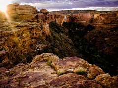
This weekend I had a wonderful camping trip to Victoria’s little known but lovely Rubicon Valley on the Rubicon River – presumably named after the famous Rubicon River that formed the boundary between the Roman province of Cisalpine Gaul to the north-west and Italy proper (controlled directly by Rome and its allies) to the south.
First a bit of history about the “Crossing of the Rubicon” by Julius Caesar.
This is from Wikipedia and links are to Wikipedia:
“Governors of Roman provinces were appointed promagistrates with imperium (roughly, “right to command”) in one or more provinces. The governor then served as the general of the Roman army within the territory they ruled. Roman law specified that only the elected magistrates (consuls and praetors) could hold imperium within Italy. Any promagistrate who entered Italy at the head of his troops forfeited his imperium and was therefore no longer legally allowed to command troops.
Exercising imperium when forbidden by the law was a capital offence. Furthermore, obeying the commands of a general who did not legally possess imperium was a capital offence. If a general entered Italy in command of an army, both the general and his soldiers became outlaws and were automatically condemned to death. Generals were thus obliged to disband their armies before entering Italy.
In January of 49BC, Caesar brought the 13th legion across the river, which the Roman government considered insurrection, treason, and a declaration of war on the Roman Senate. According to some authors, he is said to have uttered the phrase “alea iacta est“—the die is cast—as his army marched through the shallow river. Today, the phrase “crossing the Rubicon” is an idiom that means to pass a point of no return.
This led to war with Rome and Caesar’s subsequent victory in Caesar’s Civil War ensured that he would never be punished for the infraction, and ultimately led him to becoming dictator for life.
Back to Victoria’s Rubicon River:
The guides to the camping grounds advise that when traveling by car from Melbourne – Don’t Cross The Rubicon – turn right immediately before the crossing and this bitumen road will take you to the first camping area – Kendall’s camp ground, and from then on, it is a gravel road, to nearby Boy’s camp ground and then to the much smaller Tin Cup camp ground which is just past lower hydroelectric power station.
From wikipedia:
“The Rubicon River rises from the Great Dividing Range below the Blue Range east of Buxton, and flows northwest, fueled by runoff from the Blue and Cerberean Ranges, joined by the Royston River and one minor tributary, before reaching its confluence with the Goulburn River, west of the town of Thornton. The river descends 693 metres (2,274 ft) over its 26-kilometre (16 mi) course.”
The camp grounds lie along the river on the lower valley and the only facilities are drop toilets – no water (other than the very cold river water which may become turbid with silt briefly after discharges from the power stations increase the flow rate) or showers.
Nevertheless, the local tall Eucalypt forests with tall tree ferns make for a lovely backdrop and ambience which is made all the better by the fast flowing generally shallow river flowing over rounded boulders along its course and beautiful dark clear skies at night, albeit in the Sydney to Melbourne flight path directly overhead.
These camp grounds are lovely, free camp areas and great little spots to gather around the camp fire at night and star gaze on a summer evening (if you are rugged up, the Winter Milky Way is even more stunning!), and during the day, watch out for kookaburras, the odd black cockatoo, and various other native birds.
Whilst staying there for a couple of nights, it is worth having a look at the following:
- fly fishing for trout in the Rubicon or Goulburn Rivers
- there is a nearby fly fishing centre and also a trout farm but there are many spots where you can try your hand along the Rubicon River.
- historic Rubicon aqueduct tramway walking trail
- this is a lovely walk in the tall Eucalypt forests at an elevation of some 2500 feet walking along a flat old tramway path alongside an open aqueduct which has fast flowing water from the Rubicon Dam and also from the Royston Dam as both feed the small hydroelectric system
- there are 3 ways the walk can be done:
- short, flat, easy 2hr 7km return walk from Royston Power Station to Rubicon Dam
- this is perhaps the nicest section of the walks
- IF the gated road off the Royston River Rd is open, you can drive your car down to Royston Power Station, otherwise you will have to park your car on Royston River Rd and walk down to the power station then walk back up on return – this is probably an extra 1-2km each way and adds more time to the walk.
- long, mostly flat, 5hr 17km circuit walk
- park your car at the junction of Le Bruns Rd and Royston River Road
- ascend southwards along the gravel Royston River Road for 2km to a gated road on the right – walk down this road, descending to Royston Power Station
- optionally do the above short walk
- complete the circuit by walking northwards from Royston Power Station along the tramway to the Winch House at the northern end where you get nice views to the north, and then take Le Bruns Rd back to your car
- hard walk requires ~450m ascent and steep descent
- this starts at Rubicon power station near the camp grounds and passes Rubicon Falls and Rubicon Falls Power Station and requires an ascent of some 450m up to the Royston Power Station, then, optionally, you can do the walk to Rubicon Dam and back to Royston Power Station.
- return back northwards from Royston Power Station along the tramway to the Winch House at the northern end where you get nice views to the north BUT you then have to descend 1.3km at a 1 in 3 gradient which will challenge your knees and ankles!
- short, flat, easy 2hr 7km return walk from Royston Power Station to Rubicon Dam
- Cicada Nature Trail circuit
- 2hr, 6.5km gently undulating good walking path with occasional short steeper sections which links the Boys Camp Ground, Kendalls camp ground and Jungai camp, and crosses the river so that you get to walk on both sides of the river.
- a lovely walk to do before breakfast in summer while you wait for your fellow campers to wake up!
- Snobb’s Creek waterfall
- a quite impressive little waterfall some 6km off the main road at Snobbs Creek – mostly gravel – make sure you do the 100m left walk down the steps to the falls as these are far more impressive than the lazy 25m right walk section
- water flows fast over the waterfall and there is a steel viewing platform which tends to shake a bit if others are walking on it so long exposures will have to wait – optimum shutter speed for these falls is probably around 1/8th second – so best to use a camera with a great image stabiliser such as the Olympus OM-D cameras to avoid having to use a restrictive tripod and a wide angle lens such as 12mm in Micro Four Thirds format (24mm in full frame format).
- Moura Lookout
- not far from Snobb’s Creek waterfall is a turn off on a 4WD track which takes you to Moura Lookout and then back to Rubicon Valley
- we needed a chainsaw to get past a newly fallen Eucalypt and a bit of back strain!
Now for some pics:
Early morning on the Cicada Circuit:
Royston Power Station to Rubicon Dam aqueduct trail:
Royston power station
Trestle bridge for tramway – this one is not able to be crossed as severely damaged.
Rubicon Dam wall
Snobb’s Creek waterfall (handheld with the Olympus Om-D E-M1 and 12mm lens):
Eildon Dam from Moura Lookout looking north-east:
You could potentially camp at this site as there is a clearing for a fire BUT judging from the many dead tall trees evidently suffering at the hands of lightning strikes – perhaps this is not the best place to be is a thunderstorm!


